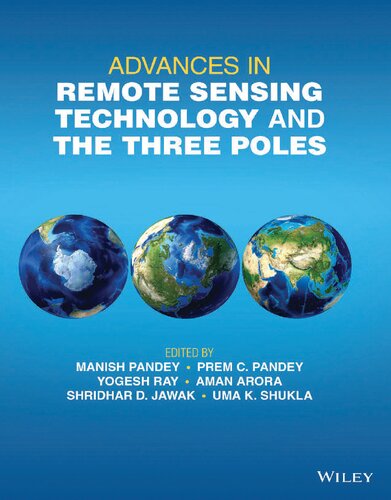
Advances in Remote Sensing Technology and the Three Poles 1st Edition by Manish Pandey,Prem Pandey, Yogesh Ray, Aman Arora, Shridhar Jawak, Uma Shukla ISBN 1119787726 978-1119787723
$50.00 Original price was: $50.00.$25.00Current price is: $25.00.
Advances in Remote Sensing Technology and the Three Poles 1st Edition by Manish Pandey,Prem Pandey, Yogesh Ray, Aman Arora, Shridhar Jawak, Uma Shukla – Ebook PDF Instant Download/Delivery: 1119787726 978-1119787723
Full download Advances in Remote Sensing Technology and the Three Poles 1st edition after payment
Product details:
ISBN 10: 1119787726
ISBN 13: 978-1119787723
Author: Manish Pandey,Prem Pandey, Yogesh Ray, Aman Arora, Shridhar Jawak, Uma Shukla
ADVANCES IN REMOTE SENSING TECHNOLOGY AND THE THREE POLES
Covers recent advances in remote sensing technology applied to the “Three Poles”, a concept encompassing the Arctic, Antarctica, and the Himalayas
Advances in Remote Sensing Technology and the Three Poles is a multidisciplinary approach studying the lithosphere, hydrosphere (encompassing both limnosphere, and oceanosphere), atmosphere, biosphere, and anthroposphere, of the Arctic, the Antarctic and the Himalayas. The drastic effects of climate change on polar environments bring to the fore the often subtle links between climate change and processes in the hydrosphere, biosphere, and lithosphere, while unanswered questions of the polar regions will help plan and formulate future research projects.
Sample topics covered in the work include:
- Terrestrial net primary production of the Arctic and modeling of Arctic landform evolution
- Glaciers and glacial environments, including a geological, geophysical, and geospatial survey of Himalayan glaciers
- Sea ice dynamics in the Antarctic region under a changing climate, the Quaternary geology and geomorphology of Antarctica
- Continuous satellite missions, data availability, and the nature of future satellite missions, including scientific data sharing policies in different countries
- Software, tools, models, and remote sensing technology for investigating polar and other environments
For postgraduates and researchers working in remote sensing, photogrammetry, and landscape evolution modeling, Advances in Remote Sensing Technology and the Three Poles is a crucial resource for understanding current technological capabilities in the field along with the latest scientific research that has been conducted in polar areas.
Advances in Remote Sensing Technology and the Three Poles 1st Table of contents:
-
Preface
- Introduction to the scope of the book and the importance of remote sensing technology in polar research.
-
Chapter 1: Introduction to Remote Sensing Technology
- Overview of remote sensing: principles, methods, and technologies.
- The role of satellites, sensors, and imaging techniques in environmental monitoring.
-
Chapter 2: Remote Sensing Applications in Polar Research
- How remote sensing is applied to study the polar regions.
- Key challenges and benefits of using remote sensing in remote, harsh environments.
-
Chapter 3: Remote Sensing of the Arctic Region
- Detailed analysis of remote sensing tools used in Arctic studies.
- Monitoring sea ice dynamics, snow cover, and climate change in the Arctic.
- Case studies and applications of remote sensing data in Arctic research.
-
Chapter 4: Remote Sensing of the Antarctic Region
- The use of remote sensing to monitor ice sheets, glaciers, and ice shelf dynamics in Antarctica.
- Studies on ecosystem monitoring, weather patterns, and climate changes in the Antarctic.
- Technological advancements in Antarctic remote sensing.
-
Chapter 5: Remote Sensing of the Himalayan (Third Pole) Region
- Applying remote sensing techniques to study the glaciers, snow, and ecosystems of the Himalayan region.
- Impacts of climate change on the Third Pole and the role of remote sensing in monitoring these changes.
-
Chapter 6: Remote Sensing for Climate Change and Environmental Monitoring
- How remote sensing contributes to tracking long-term climate patterns in polar regions.
- Detecting environmental changes, such as ice melt, permafrost thawing, and shifting ecosystems.
-
Chapter 7: Advances in Satellite Imagery and Sensor Technology
- The latest developments in satellite technology, imaging sensors, and data processing techniques.
- High-resolution imagery and multi-spectral remote sensing for detailed analysis.
-
Chapter 8: Data Integration and Modeling in Polar Research
- Integrating remote sensing data with ground-based observations and modeling techniques.
- Case studies on modeling polar systems and predicting future environmental changes.
-
Chapter 9: Challenges in Polar Remote Sensing
- Addressing issues like data gaps, weather conditions, and the difficulty of obtaining consistent data in polar regions.
- Ethical and logistical challenges in conducting remote sensing in sensitive areas.
-
Chapter 10: Policy and Global Cooperation in Polar Research
- The role of international cooperation in polar research and data sharing.
- Policy implications for climate change, conservation, and sustainable management of polar regions.
-
Chapter 11: Future Directions in Remote Sensing for Polar Regions
- Emerging technologies and trends in remote sensing for polar research.
- Future applications, including autonomous platforms and AI integration for data analysis.
-
Conclusion: The Role of Remote Sensing in Understanding the Three Poles
- Summary of key findings and insights from remote sensing research in the polar regions.
- The importance of remote sensing in addressing global environmental challenges and the future of polar research.
-
Glossary
- Definitions of key terms used in remote sensing and polar studies.
-
Index
- A comprehensive index for easy reference of topics covered in the book.
People also search for Advances in Remote Sensing Technology and the Three Poles 1st :
advances in remote sensing technology and the three poles
advances of satellite remote sensing technology in earthquake prediction
development of remote sensing technology
how do scientists use remote sensing technology
remote sensing technology examples
Tags:
Manish Pandey,Prem Pandey,Yogesh Ray,Aman Arora,Shridhar Jawak,Uma Shukla, Remote Sensing,Three Poles
You may also like…
Earth Sciences Cartography
Science (General) - Research & Development
Research Developments in Geotechnics Geo Informatics and Remote Sensing Hesham El-Askary
Earth Sciences - Geography
Earth Sciences - Geography
Sea Ice: Physics and Remote Sensing 2nd Edition Mohammed Shokr


