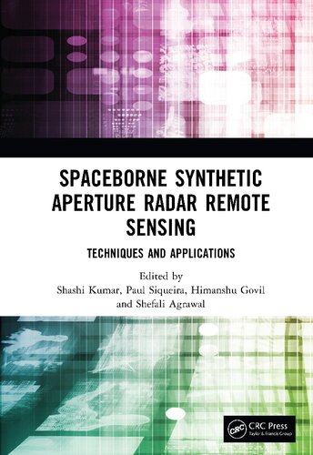
Spaceborne Synthetic Aperture Radar Remote Sensing: Techniques and Applications 1st Edition by Shashi Kumar 9781000803181 100080318X
$50.00 Original price was: $50.00.$25.00Current price is: $25.00.
Spaceborne Synthetic Aperture Radar Remote Sensing: Techniques and Applications 1st Edition Shashi Kumar – Ebook Instant Download/Delivery ISBN(s): 9781000803181, 100080318X
Product details:
- ISBN 10: 100080318X
- ISBN 13:9781000803181
- Author: Shashi Kumar
Spaceborne Synthetic Aperture Radar Remote Sensing
Techniques and Applications
Table contents:
List of Contributors
1 Synthetic Aperture Radar Remote Sensing
1.1 Introduction
1.1.1 Coherent Radar
1.2 Synthetic Aperture Radar (SAR) Geometry
1.3 Normalized Radar Backscatter Cross-Section
1.4 Local Angle of Incidence
1.5 SAR Polarizations
1.6 SAR imaging mode
References
2 Speckle Reduction in SAR Images
2.1 Introduction
2.2 SAR Imaging Modalities
2.2.1 Amplitude/Intensity Modality
2.2.2 Polarimetric Modality
2.2.3 Multi-Frequency Modality
2.2.4 Interferometric Modality
2.2.5 Polarimetric-Interferometric Modality
2.3 Single-Channel SAR Images Restoration
2.3.1 Speckle Model
2.3.2 Despeckling Filters
2.3.3 Despeckling Evaluation Metrics
2.4 Multi-Channel SAR Images Restoration
2.4.1 Speckle Model
2.4.2 Despeckling Filters
2.4.3 Despeckling Evaluation Metrics
2.5 Open Issues and Future Trends
Note
References
3 Polarimetric Interferometric Decomposition
3.1 Introduction
3.2 Limitations in Target Identification
3.3 Polarimetric Interferometric Fundamentals and Advancements
3.3.1 Radar Imaging
3.3.2 Polarization of EM Waves
3.3.3 Scattering Matrix
3.3.4 PolSAR
3.3.5 Scattering Vectors, Coherency Matrix, and Covariance Matrix
3.3.6 Target Decomposition
3.3.7 Model-Based Decomposition
3.3.8 Classical Three-Component Decomposition Model
3.3.9 Four-Component Decomposition Model
3.3.10 Polarization Orientation Angle (POA) Compensation
3.4 Polarimetric SAR Interferometry (PolInSAR)
3.4.1 Polarimetric Interferometric Decomposition Model
3.4.2 Hybrid Decomposition
3.4.3 Data Preprocessing
3.4.4 Fine Co-registration
3.4.5 PolInSAR Coherence Estimation
3.4.6 Coherence Optimization and Selection
3.4.7 Entropy and Alpha Angle
3.4.8 Model Workflow and the Constraint Equation
3.5 Experiment with Spaceborne Data
3.5.1 Coherence Selection
3.5.2 Coherence Optimization
3.5.3 Scattering Ambiguity in Generic Decomposition Models
3.6 Constraint Equation
3.7 Results of Hybrid Decomposition Model
3.7.1 Comparative Analysis
3.7.2 Comparison with Existing Decomposition Models
3.7.3 Scattering Entropy Evaluation
3.7.4 Limitation of POA Compensation
3.8 Discussions
3.8.1 Factors Affecting PolInSAR Coherence
3.8.2 PolInSAR Coherence and Decomposition Modeling
3.8.3 Statistical Significance of PolInSAR Coherence
3.9 Conclusion and Recommendations
References
4 Implementation of Machine Learning Classification Models on Multifrequency Band SAR Dataset
4.1 Introduction
4.2 Study Area
4.3 Methodology
4.4 Pre-processing
4.5 PolSAR Decomposition
4.6 Training Data Generation
4.7 Methods for Machine Learning Classifiers
4.7.1 k-Nearest Neighbor (KNN) Classification Model
4.7.2 Naïve Bayes Classification
4.7.3 Random Forest Classification
4.7.4 Support Vector Machine Classification
4.8 Conclusion and Recommendations
References
5 Implementation of Neural Network-Based Classification Models on Multifrequency Band SAR Dataset
5.1 Introduction
5.2 Neural Network Models
5.3 Multi-Layer Perceptron (MLP) Classification Model
5.3.1 Study Area
5.3.2 Methodology
5.3.3 Pre-processing
5.3.4 PolSAR Decomposition
5.3.5 Training Data Generation
5.3.6 Architecture of Multi-Layer Perceptron (MLP) Classification Model
5.4 Compact CNN Classification Model Using Sliding-Window Operations
5.5 The DeepLabv3+ Classification Model
5.6 Conclusion and Recommendations
References
6 Improved Data Fusion-Based Land Use/Land Cover Classification Using PolSAR and Optical Remotely Sensed Satellite Data: A Machine Learning Approach
6.1 Introduction
6.1.1 Problems in Monitoring Land Use/Land Cover Change
6.1.2 SAR Polarimetry
6.1.3 Application of PolSAR in Land Cover (LC) Classification
6.1.4 Advantages of PolSAR Over Optical Datasets
6.2 Materials and Methods
6.2.1 Study Area and Datasets
6.2.2 Polarimetric Decomposition
6.2.3 Data Fusion Techniques Used
6.2.4 Selection of Classifiers
6.2.5 Methods
6.3 Results and Conclusion
6.3.1 Polarimetric Decomposition
6.3.2 Classification Results
6.4 Conclusions
References
7 Polarimetric SAR Descriptors for Rice Monitoring
7.1 Introduction
7.2 Methodology
7.2.1 The Kennaugh Matrix Framework
7.2.2 Target Characterization Parameters
7.2.3 Scattering Power Decomposition
7.3 Study Area and Satellite Data
7.3.1 Indian Test Site
7.3.2 Spanish Test Site
7.3.3 In-Situ Measurement Procedures and Rice Morphology
7.4 Results and Discussion
7.4.1 Temporal Analysis Over Two Test Sites and Different Incidence Angle
7.4.2 Rice Phenology Classification
7.5 Conclusions
Acknowledgments
Note
References
8 Synergistic Fusion of Spaceborne Polarimetric SAR and Hyperspectral Data for Land Cover Classification
8.1 Introduction
8.1.1 Background
8.2 Study Area and Datasets Used
8.2.1 Study Area
8.2.2 Datasets Used
8.3 Research Methodology
8.3.1 Processing of the Datasets
8.3.2 Pixel-Level Fusion
8.3.3 Feature-Level Fusion
8.3.4 Decision-Level Fusion
8.4 Classification and Accuracy Assessment
8.4.1 Classification
8.4.2 Accuracy Assessment
8.4.3 Comparative Analysis
8.5 Results and discussion
8.5.1 Results
8.5.2 Comparative Analysis of all The Three Levels of Fusion of Hyperspectral and PolSAR Data
8.6 Conclusion and Recommendation
8.6.1 Conclusion
8.6.2 Recommendations
References
9 Marine Oil Slick Detection Using Synthetic Aperture Radar Remote Sensing Techniques
9.1 Introduction
9.2 Types of Oil
9.3 Weathering Processes
9.4 Major Oil Spill Incidents
9.5 Cleanup Procedure and Associated Costs
9.5.1 Monetary Costs Associated With Oil Spills
9.6 Oil Spill Detection Procedure
9.7 SAR Remote Sensing for Oil Spill Detection
9.7.1 Polarization Signature Analysis of the Oil Spill Patches
9.7.2 Decomposition Models
9.8 Separability Analysis
9.9 Classification Techniques
9.9.1 Support Vector Machine
9.9.2 Wishart Supervised Classification
9.10 Accuracy Assessment
9.10.1 AUC (Area Under the Curve) and ROC (Receiver Operating Characteristics)
9.11 Conclusions and Future Work
References
10 Spaceborne C-Band PolSAR Backscatter and PolInSAR Coherence-Based Modeling for Forest Aboveground Biomass Estimation
10.1 A Brief History of Applications of Synthetic Aperture Radar (SAR) for Biophysical Parameter Retrieval
10.2 Doon Valley Forests at a Glance
10.3 Overview of the Fundamentals and Methodological Development
10.4 Illustration of the Outcomes of the Analysis
10.5 Inferences
References
11 Analysis of Polarimetric Techniques for Characterization of Glacial Feature
11.1 Introduction
11.2 Study Area and Datasets
11.2.1 Study Area
11.2.2 Datasets
11.4 Methodology
11.4.1 Calculation of Backscattering Coefficient σ0
11.4.2 Scattering Matrix
11.4.3 Target Decomposition
11.4.4 Stokes Parameters
11.5 Results and Discussion
11.5.1 Backscattering Coefficient σo Image Interpretation
11.5.2 Results of H-A-α Decomposition
11.5.3 Results of Freeman–Durden Decomposition
11.5.4 Stokes Parameter-Based Approach
11.6 Conclusion
References
12 Spaceborne SAR Application to Study Ice Flow Variation of Potsdam Glacier and Polar Record Glacier, East Antarctica
12.1 Introduction
12.2 Role of Spaceborne SAR in Antarctica
12.3 Glacier Velocity Estimation Using Spaceborne SAR
12.4 Study Area and Dataset
12.5 Methodology
12.5.1 Glacier Velocity Estimation Using DInSAR
12.5.2 Glacier Velocity Estimation Using Offset Tracking
12.5.3 Field Measurements
12.6 Results and Discussion
12.6.1 DInSAR-Based Glacier Velocity Estimation for Potsdam Glacier
12.6.2 Offset Tracking Based Glacier Velocity Estimation for PRG
12.7 Conclusion
References
13 Multi-Temporal SAR Interferometry: Theory, Processing, and Applications
13.1 Introduction
13.2 Synthetic Aperture Radar (SAR)
13.3 Geometric Distortions in SAR
13.4 SAR Interferometry (InSAR)
13.5 MT-InSAR (Advanced InSAR Technique) Processing Chain
13.5.1 StaMPS: Stanford Method for Persistent Scatterers
13.6 Monitoring of Landslides in Nainital (Uttarakhand, India) Using StaMPS
13.7 Monitoring of Landslides in Nainital (Uttarakhand, India) Using StaMPS
13.8 Surface Deformation Measurement of the L’Aquila Region
13.9 Conclusions
References
14 SAR for Cultural Heritage Monitoring
14.1 Remote Sensing for Cultural Heritage Sites
14.2 Study Area
14.2.1 Angkor Wat
14.2.2 Structure
14.2.3 Hydraulic Network
14.2.4 Geomorphological
14.3 Dataset
14.4 PSInSAR Processing of Sentinel Data
14.5 Results
14.5.1 PS Identification
14.5.2 LOS Displacement of 2006 to 2009
14.5.3 LOS Displacement of 2014 to 2018
14.5.4 LOS Displacement 2017 to 2021
14.6 Discussion
14.7 Conclusion
References
15 Extraction and Evaluation of Lineaments From DEMs Generated from Different Bands of Microwave Data and Optical Data: A Case Study for Jahazpur Area, Bhilwara, India
15.1 Introduction
15.2 Study Area
15.2.1 Geological Settings of the Study Area
15.3 Data Used
15.3.1 Microwave Data
15.3.2 Optical Data
15.4 Methodology
15.4.1 Generation of DEM
15.4.2 Comparison of DEMs
15.4.3 Automatic Lineament Extraction
15.4.4 Comparison of Extracted Lineaments
15.5 Results
15.6 Conclusions
Acknowledgments
References
16 Scatterer-Based Deformation Monitoring Induced Due to Coal Mining by DInSAR Techniques
16.1 Introduction
16.2 Study Area and Data Used
16.2.1 Study Area
16.2.2 Datasets Used
16.3 Methodology
16.3.1 Baseline Estimation
16.3.2 Co-registration
16.3.3 Generation of Interferogram
16.3.4 Coherence Estimation
16.3.5 Topographic Phase Removal
16.3.6 Phase Unwrapping
16.3.7 Phase Filtering
16.3.8 Identification and Selection of Persistent Scatterers
16.3.9 Atmospheric Phase Screen Estimation and Its Correction
16.3.10 Persistent Scatterer Coherence Map Generation
16.3.11 Generation of Cumulative Displacement Map and Monitoring Deformation History
16.4 Results and Discussion
16.5 Conclusion
References
17 An Insight to the Lunar Surface: Characterization From the L- and S-Band Polarimetric Data
17.1 Introduction
17.2 The Moon: A Catapult for Future Space Missions
17.2.1 Importance of the Moon in the Indian Space Program
17.2.2 Human Footprints on the Moon: The Manned Missions on the Lunar Surface
17.2.3 The Chronicle of Lunar Exploration: Lander, Orbiter, and Impactor
17.2.4 Future Lunar Missions
17.3 The New Era of SAR-Based Missions for the Lunar Surface
17.3.1 Chandrayaan-1
17.3.2 Lunar Reconnaissance Orbiter
17.3.3 Chandrayaan-2
17.4 Crater Formation
17.4.1 Types of Craters
17.5 Lunar Pyroclastic Deposits
17.6 Lunar Rilles
17.7 South Pole
17.8 Circular Polarization Ratio
17.9 Decomposition Techniques
17.9.1 m-δ Decomposition
17.9.2 m-χ Decomposition
17.9.3 m-α Decomposition
17.10 Study Area and Datasets
17.10.1 Shackleton Crater
17.10.2 Erlanger Crater
17.10.3 Slater Crater
17.10.4 Rimae Sulpicius Gallus
17.11 Results
17.11.1 Shackleton Crater
17.11.2 Analysis of CPR
17.11.3 Slater Crater
17.11.3.1 Barnes Decomposition
17.11.4 Erlanger Crater
17.11.5 Rimae Sulpicius Gallus
17.12 Conclusions
References
18 Synthetic Aperture Radar (SAR) Data Calibration and Validation
18.1 Introduction
18.2 Significance of SAR Calibration
18.3 Types of SAR Calibrations
18.3.1 Internal Calibration
18.3.2 External Calibration
18.4 Corner Reflectors
18.4.1 Types of Corner Reflectors
18.4.2 Construction and Fabrication of Corner Reflectors
18.4.3 Selection of Calibration Site and Deployment of Corner Reflectors
18.5 Types of SAR Calibration and Validation
18.5.1 Radiometric Calibration
18.5.2 Geometric Calibration
Appendix
References
Index
People also search:
spaceborne synthetic aperture radar
spaceborne synthetic aperture radar remote sensing techniques and applications
spaceborne synthetic aperture radar and noise jamming
spaceborne synthetic aperture radar (sar)
digital beamforming for spaceborne reflector-based synthetic aperture radar
You may also like…
Earth Sciences Cartography
Computers - Computer Science
Earth Sciences - Geography
Uncategorized
Polarimetric Synthetic Aperture Radar Principles and Application 1st Edition Irena Hajnsek
Uncategorized
Computers - Programming
Earth Sciences - Oceanography
Nonlinear Ocean Dynamics: Synthetic Aperture Radar 1st Edition Maged Marghany

